Historical Maps of the Americas
Includes historical overview maps, nations, regions, and individual cities.
www.lib.utexas.edu/maps/historical/history_americas.html
Historical Maps of Asia
Includes overview maps as well as nations, principal cities, and military maps of the Asia-Pacific Theater in World War II.
www.lib.utexas.edu/maps/historical/history_asia.html
Motco
Retailer and reference database of topographical prints, maps, prospects, and panoramas of London, the Thames, and the U.K.
www.motco.com
Military Maps of WWII
From a variety of sources.
mapww2.narod.ru
McMurry University: Historical Maps
Features historical maps of Texas, the United States, and Mexico. Also includes maps of the Holy Roman Empire and Sub-Saharan Africa.
www.mcm.edu/academic/depts/history/maplink.htm
Maps of the Pimer?a
Original, rare, and historic maps portraying a region of New Spain from the 16th to the 19th century. From the University of Arizona Library Map Collection.
dizzy.library.arizona.edu/pimeria
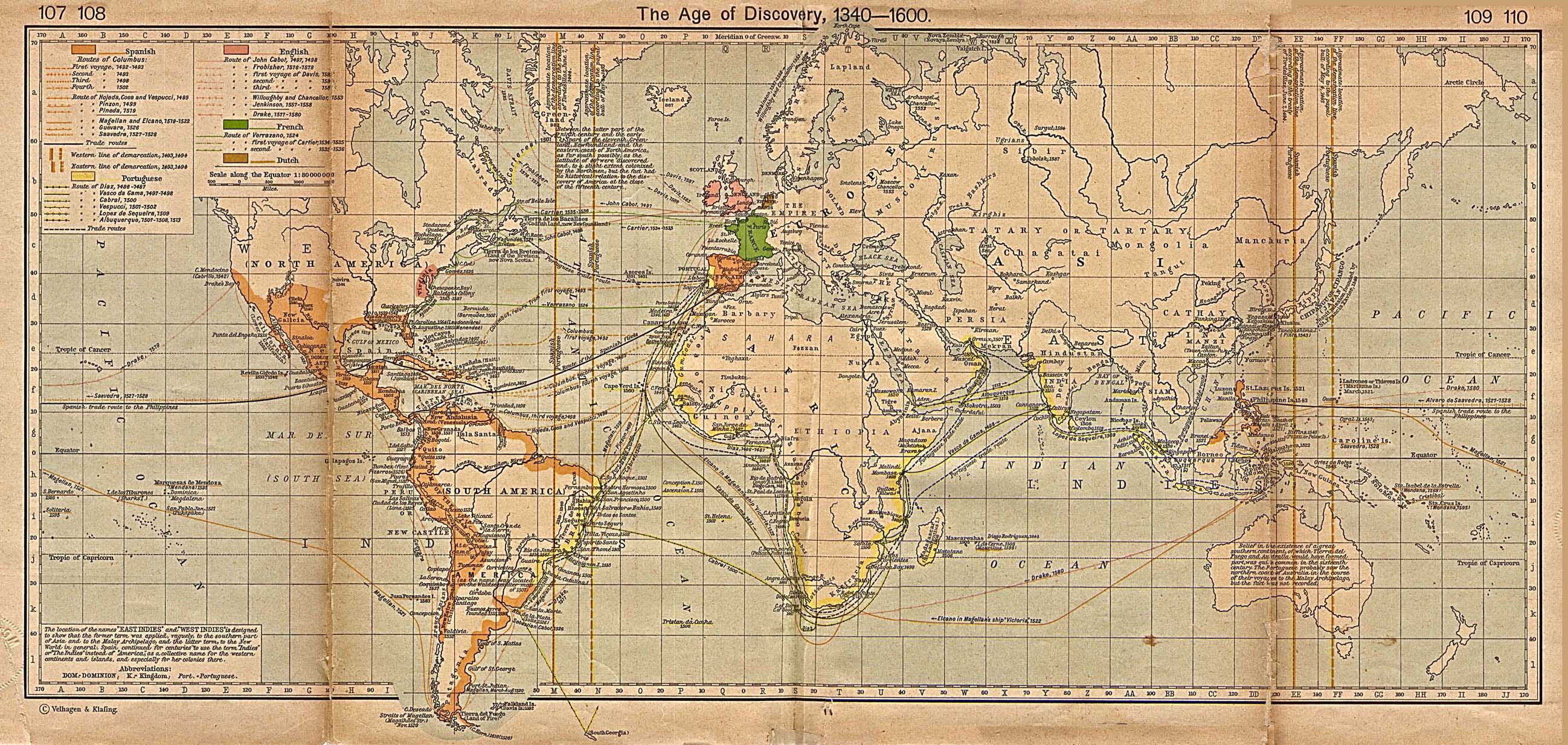
Age of Discovery 1340-1600
World map illustrating the routes and events of Spanish, Portuguese, English, French, and Dutch explorers.
www.lib.utexas.edu/maps/historical/shepherd/explorer_map_shepherd.jpg
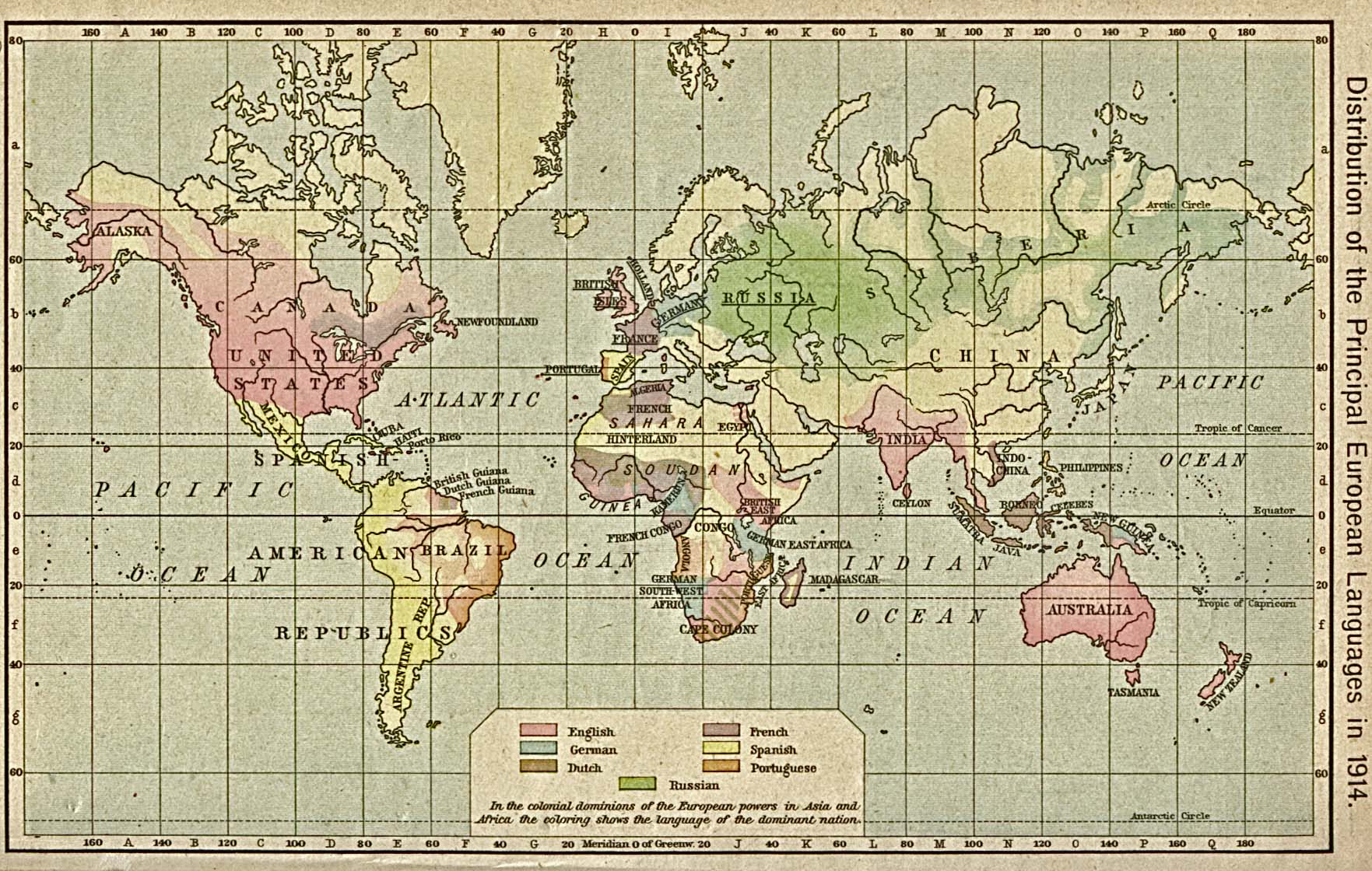
Distribution of European Languages
World map illustrating the spread of European languages, from 1914.
www.lib.utexas.edu/maps/historical/shepherd/euro_language_dist_1914.jpg
Nevada History in Maps
Features historic maps of the territory and state of Nevada and surrounding regions. From the the University of Nevada, Reno.
www.delamare.unr.edu/maps/digitalcollections/nvhistory/Default.htm
 Help us improve the Yahoo! Directory - Share your ideas